The Arctic is an increasingly attractive location for a variety of industries - from seismic vessels and global freighters, to a growing commercial fishing fleet operating in the Barents Sea .
KSAT offers fast delivery of images and information from satellites, primarily from Synthetic Aperture Radar. Radar from satellites is the ideal tool for covering large areas and to detect objects and features on the sea surface through clouds, and even in darkness.
KSAT, using all available satellites on the market in a virtual constellation, can provide maximum frequency (revisit-times). Downlinking that data at our uniquely located ground stations in the Arctic, ensures that updated information to entities operating in the region is available shortly after acquisition.
Proactive monitoring of ice movements and oil spills in the Arctic Region has increased in demand and following are some recent examples of services KSAT has delivered and projects/expeditions we have supported.
KSAT supported Polar expedition with high resolution radar images in a critical phase
After more than 85 days expedition in the Arctic, the two polar explorers Børge Ousland and Mike Horn was not able to reach Svalbard as planned due to the constantly changing ice conditions. High resolution satellite images from KSAT was used to try to find a way around dangerous leads in the ice to bring them safely to the vessel Lance.
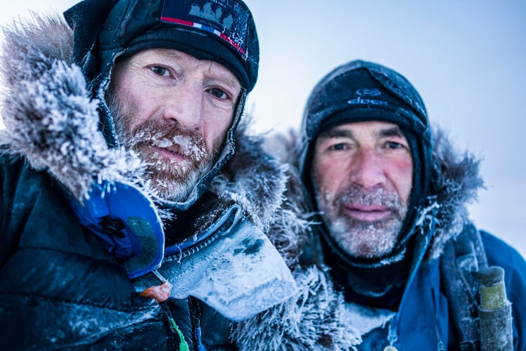
Image: Selfie of Børge Ousland and Mike Horn, from their expedition over North Pole.
KSAT supported The Norwegian Coast Guard´s historic voyage to the North Pole
The Norwegian Coast Guard vessel KV Svalbard became the first Norwegian ship to reach the North Pole in August 2019. KSAT supported the expedition with daily deliveries of radar satellite images, showing in detail the updated ice situation.
KV Svalbard could study the leads in the ice and find the fastest and safest route to the North Pole. Thanks to the fast deliveries of updated satellite scenes and the expertise in the crew, KV Svalbard held a higher speed of advance and reached the pole much faster than what was expected.
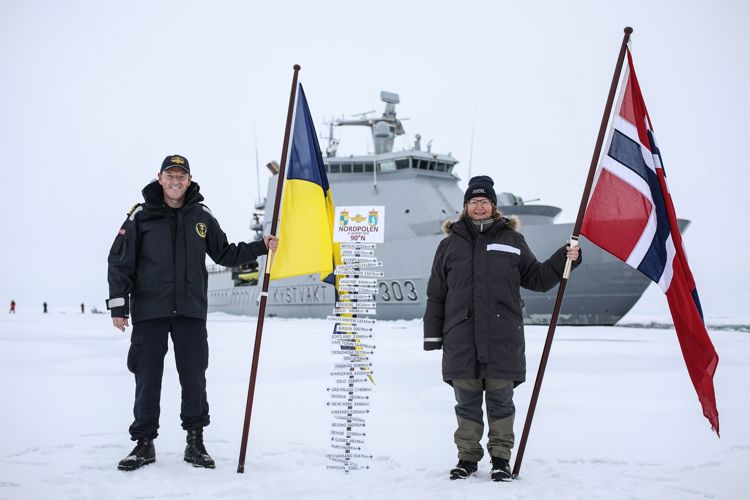
Image: Captain Geir-Magne Leinebø and CAATEX expedition leader Dr. Hanne Sagen at the North Pole. (Credit: Norwegian Coast Guard)
Satellite images from KSAT replacing helicopter surveillance over Greenland
The Danish Meteorological Institute (DMI) ice service are basing their in-shore ice charting around Cape Farewell in the southern part of Greenland on radar images from KSAT. The satellite images can be delivered independent of cloud, fog or darkness. The transition to satellite imagery as observation method is part of the modernization of in-shore ice charting in the Southern part of Greenland.
DMI says this results in a better ice-service for Greenland, making observation less vulnerable to darkness and fog, and more cost effective.
KSAT provided emergency support during vessel stranding in extreme conditons
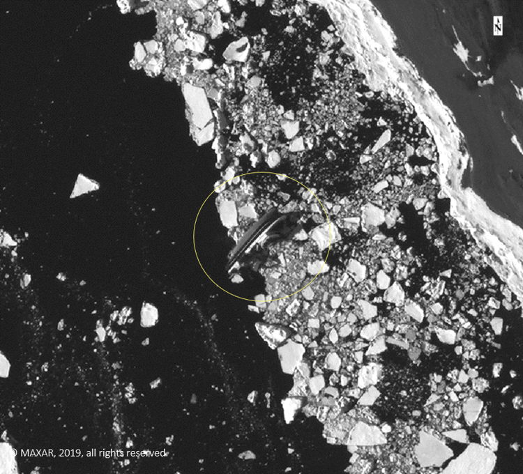
How to do damage assessment in one the most harsh and vulnerable environments in the world? When the fishing vessel Northguider stranded in Hilopenstredet, North of Svalbard, KSAT supported The Norwegian Coastal Administration with emergency satellite images and expert analysis. Using the high-resolution optical images, it was possible to do damage assessment of the vessel, and closely monitor the vessel for movement and potential oil leaks.
KSAT will have a key role in satellite-based broadband in the Arctic
KSAT will provide ground station services to the new Highly Elliptical Satellites (HEO) mission, designed to provide satellite-based broadband in the Arctic. KSAT will as part of the agreement establish a Satellite Operation Centre for satellite operation and control. The latter together with Space Norway.
KSAT will build 4 new antennas and extend to a new location to provide ground station services to the HEO mission. The Satellite Operation Centre will be established at KSAT headquarters in Tromsø.
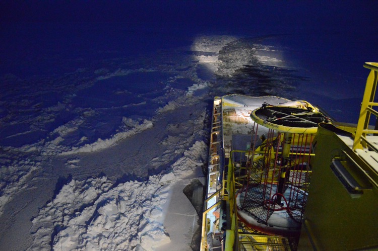
KSAT supported the vessel Tor Viking through the Northern Sea route
On their successful transit from Pacific to Norwegian port, Tor Viking chose the Northern Sea Route saving 12 days compared to sailing through Panama. Finding leads within the difficult ice situation, avoiding areas of heavy ice was important to save time and ensure a safe journey. Radar images from several satellite missions was ordered to ensure continuous coverage along the route and delivered by KSAT in Near-real time (NRT).
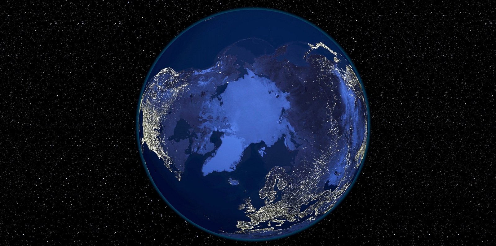
(Title image: The Arctic at night. Satellite image of the Earth at night, set against a background of stars, centred on the Arctic. NASA/NOAA/SPL, Alamy stock photo)