

Header photo/copyright: Copernicus Sentinel data (2019)/ESA/Produced and analysed by KSAT
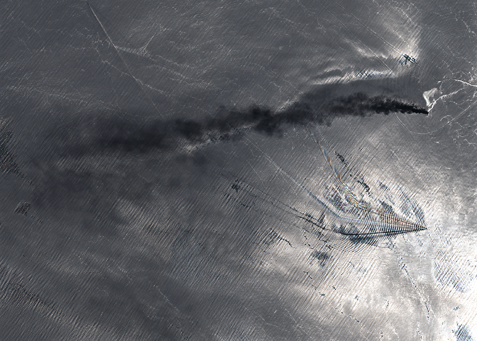
Early morning Thursday a Norwegian tanker was reported on fire due to an incident in the Gulf of Oman. The dedicated orderdesk at KSAT have done an extensive effort during the day to map the aquisition possibilities and get hold of updated satellite imagery. The featured image was taken by Sentinel-2 , an optical satellite owned and operated by European Space Agency, downloaded and analysed by KSAT - Today , 13 june at 06.46 UTC.
We are following the situation closely, and by drawing on our unique access to satellites we aim to generate further imagery and oil spill detection reports in the coming days.
Use of multiple satellites ensures global coverage and maximum frequency and is therefore an indispensable tool when monitoring vessel traffic and oil slicks.
KSAT is a world-leading provider of oil spill monitoring and other sophisticated detection technologies based on satellite data, both Synthetic Aperture Radar (SAR) and high-resolution optical satellite data. The key focus is maritime situational awareness, which includes Near Real-Time (NRT) ship detection and oil spill monitoring, ice monitoring and other related services. Read more about our services here.