Scaling a ground network sounds straightforward: add more antennas.
In reality, it is more demanding. Physics determines when you can communicate with a spacecraft. Geometry determines for how long. Operations determine whether those minutes create value.
Ten years ago, KSATlite began with a simple bet: the ground segment had to become lighter, more automated, and easier to integrate, because SmallSat operators were moving fast. What followed was not just network expansion, but a shift from delivering “a service” to engineering a global capability, one that respects orbital dynamics while removing as much operational friction as possible.
This chapter is about that evolution.
Read the first chapter in our series about KSATlite
Physics sets the rules
In Low Earth Orbit (LEO), satellites move quickly, completing an orbit roughly every 90–120 minutes. Communication does not happen continuously; it happens in short, repeating windows. That single fact shapes everything: how often you can command, how fast you can retrieve payload data, and how long you must wait if you miss a pass.
But a “contact” is not binary. It is geometry in motion.
From the ground, a satellite rises above the horizon, climbs to maximum elevation, and sets again. Link quality changes along that arc. At lower elevations, signals travel through more atmosphere, slant range increases, and susceptibility to obstructions and margin limitations grows. This is why operational systems define minimum elevation thresholds, and why theoretical visibility does not always translate into usable minutes.
Inclination adds another layer. Near-polar and sun-synchronous orbits repeatedly sweep across high latitudes, creating frequent access opportunities for polar stations. Sun-synchronous missions, designed to pass regions at consistent local solar times, enable stable imaging conditions, but also create predictable and sometimes congested access patterns if ground infrastructure is not built for scale.
This is where KSAT’s geography becomes more than a footprint on a map, it becomes an orbital advantage.
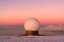
At 78°N, Svalbard sits beneath nearly every polar spacecraft. Paired with Troll in Antarctica at 72°S, KSAT operates a true pole-to-pole backbone. For most sun-synchronous missions, this enables contact opportunities twice per orbit as a bare minimum, a structural advantage rooted in Earth’s rotation and orbital design.
Geography sets the rhythm. The question becomes: what do you do with the minutes you get?
From antennas to network architecture
Historically, ground segment latency was not only about RF performance. It was about process. Manual scheduling. Fragmented interfaces. Disconnected telemetry systems. Slow data handoffs after downlink. Much of the delay in space operations happened on the ground, not because antennas were unavailable, but because the surrounding architecture was heavy.
KSATlite approached this differently.
The visible change over the decade has been scale, toward more than 200 antennas across 35 locations by 2028. The invisible change has been architectural: one operational surface across a distributed and heterogeneous infrastructure.
Operators interact through unified interfaces and automation. Behind that simplicity, the system orchestrates across sites, assets, regulatory environments, and mission constraints. The complexity remains, but it is absorbed by the network rather than exposed to the user.
That distinction matters for latency.
For many missions, the largest time component is not the RF downlink itself. It is the waiting time until the next viable contact, plus any avoidable delay introduced during and after the pass. Orbital dynamics governs the first part. System design governs how effectively those minutes are transformed into mission value.

Figure 1: KSATlite global network evolution to 2028 including potential future stations (in grey).
How KSATlite reduces latency, end‑to‑end (without pretending it can defeat physics)
It is useful to separate latency into two components:
Time until contact.
Largely dictated by orbit geometry and station placement. This is where the polar backbone is critical for sun-synchronous and high-inclination missions, and where carefully positioned mid-latitude nodes reduce revisit gaps for inclined constellations.
Time from contact to usable data.
This is where ground architecture transforms the experience.
A six-minute pass only creates value if the data is immediately available to mission systems, analytics pipelines, or decision-makers. If data moves through fragmented paths or requires manual intervention before reaching the cloud, the operational advantage of the pass is diminished.
In 2025, KSAT deepened its collaboration with AWS, integrating AWS Ground Station capabilities into KSATlite’s architecture. The goal was straightforward: reduce the distance between antenna and analytics. Downlink is no longer the finish line. Delivery into scalable cloud environments, without manual steps, reduces hidden latency and shortens time to action. Segmented file transfer delivery from any ground stations to any datacentre enables operators to get their data in near real time.
When combined with automation at the scheduling and execution layers, this integration reshapes not physics, but the portion of latency operators can control.

The hard limit of ground networks—and why HYPER exists
Even a global ground network has limits. When a satellite is not in view of any station, it cannot downlink. That gap between passes is not a software problem. It is geometry.
HYPER is KSAT’s response to that boundary.
By adding an in-orbit relay layer, sometimes described as “orbiting ground stations”, customer satellites can transmit data to relay assets, which then route it into KSAT’s terrestrial infrastructure. The objective is not to replace the ground network, but to extend it: reduce latency gaps, increase availability, and introduce routing flexibility, including sovereignty-driven delivery options.
The Hyperion demonstration mission marks a key milestone in validating this end-to-end data path and making the relay layer compatible with KSATlite’s operational model. The ambition is straightforward: allow customers to explore low-latency relay services without rebuilding their workflows.
HYPER is an augmentation of KSATlite and the global ground network, not a replacement. It builds on the same philosophy of simplicity, compatibility, and transparency, while adding a new path through orbit when Earth’s geometry becomes the constraint.
As Edvard Foss, General Manager for Hyper, describes it:
“HYPER is an augmentation of KSATlite and our global ground network, not a replacement. It builds on the same philosophy of simplicity, compatibility and transparency, while introducing a relay layer in orbit fully integrated with the infrastructure customers already trust. The result is more routing options, higher availability and lower latency.”
What “network‑of‑networks” really means after ten years
When space actors talk about “blackouts,” the number often hides complexity. Availability depends on orbit type, inclination, elevation constraints, link budgets, regulatory environments, and operational priorities. Are you optimizing for maximum minutes, highest reliability, shortest revisit gap, or minimum time-to-cloud?
Orbital mechanics makes trade-offs unavoidable.
Over the past decade, KSATlite has treated the ground segment not as a collection of antennas, but as a true network:
- Choose geography aligned with the orbits customers fly.
- Scale operations through automation and unified interfaces.
- Integrate cloud delivery to remove hidden latency.
- Add an in-orbit relay layer when ground geometry alone is not enough.
Each step has extended not just coverage, but optionality — the number of ways a mission can achieve the same outcome through one operational surface.
Ten years ago, KSATlite started by simplifying access to a distributed infrastructure. Today, it connects a pole-to-pole backbone, cloud-native data paths, and an emerging relay layer in orbit, while aiming to feel simple to the operator.
The principle has not changed:
Accept the physics. Remove the friction. Keep the system usable.